

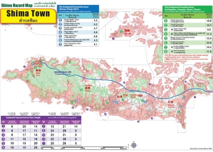
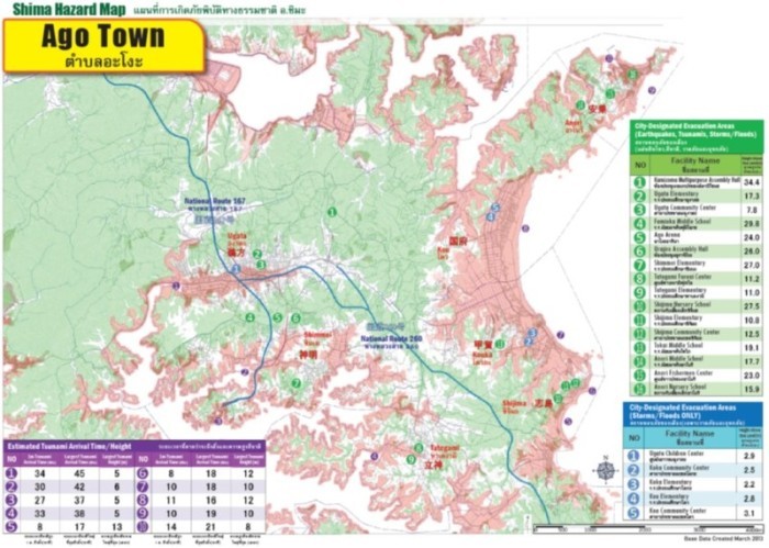
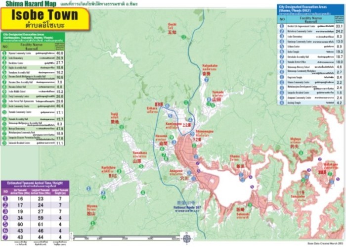
Shima Hazard Map (แผนที่ภัยพิบัติ อ.ชิมะ)
This Hazard Map is based off the "Nankai Trough Megaquake Tsunami Prediction" announced by the Cabinet of Japan in 2012. This prediction is based off what is thought to be the largest scientifically possible earthquake, so the likelihood of such an earthquake occuring is extremely low, and is not the next predicted Nankai Trough Earthquake (Tokai・Tonankai・Nantokai Earthquakes), but in order to save lives, we all need to always be mentally prepared for the possibility of a large tsunami occuring. If a large natual disaster does occur and each of us is able to take the best course of action, it will help save lives. This booklet has compiled the hazard maps of the former towns (before Shima was formed). The individual hazard maps of local organizations were separately distributed. Because we do not know when and where an earthquake will occur, please make use of all the different types of hazard maps.


ShimaHazardMapPDF(PDF:19.3MB) (PDFファイル: 19.4MB)
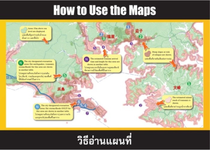
How to Use the Maps (วิธีอ่านแผนที่)
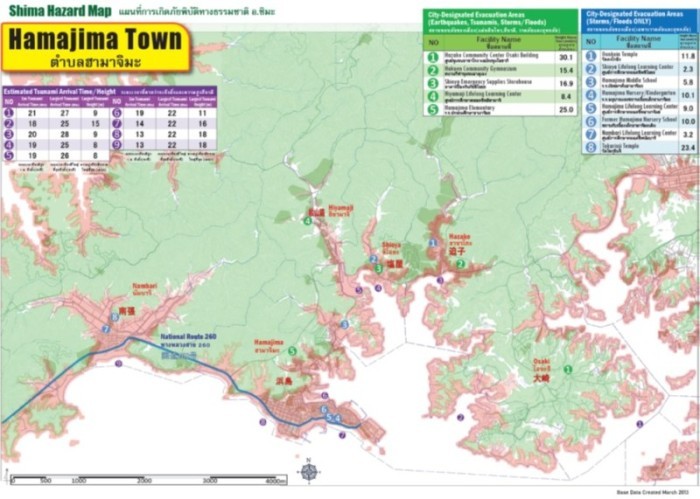
Hamajima
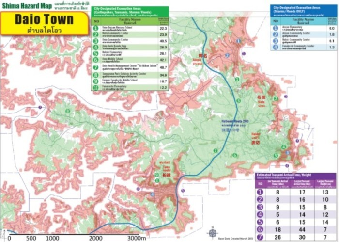
Daio
Shima
Ago
Isobe
更新日:2023年01月10日